I have been hearing about Gunung Hitam ever since few of my friends did this torturous climb, and was repeatedly told “you should do this, you will love it”
Few days before the climb I was told that Hitam had few landslides and it may not be safe to hike, but the guide who assisted me in getting permits assured me that if the Forestry is issuing permits the forest must be safe. I agreed with her.
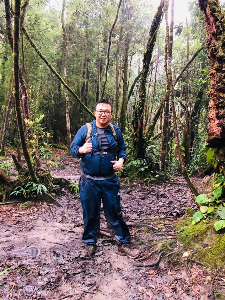
photo credit: Luan
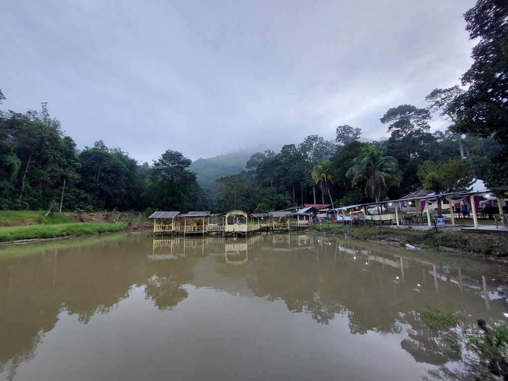
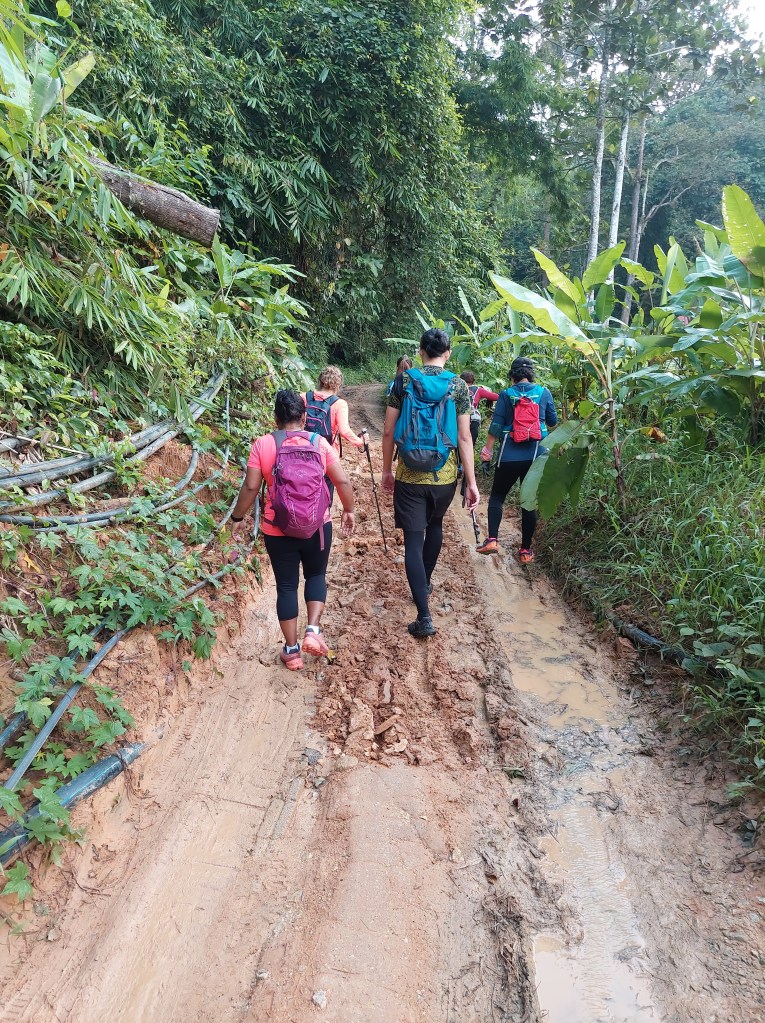
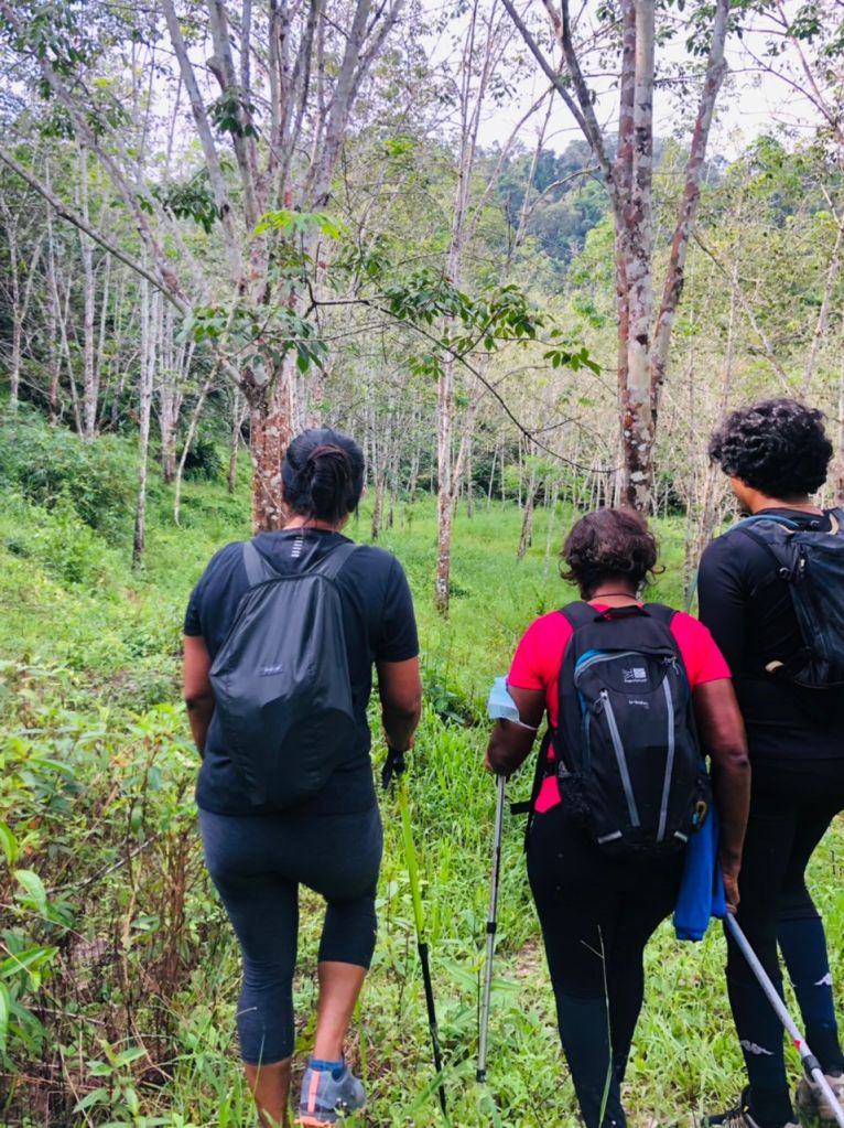
After we parked at a parking near an Orangasli village, the leader for the hike Jaya reminded everyone how important it is to warm up before the hike. But I guess we were all too eager to start the hike, we just twisted and shaked our limbs a bit and hurried to start the hike. I started my garmin not knowing how long it takes till the trail head, and to my surprise it’s a 2km walk.
Photo Credit: LuanPhoto Credit: Luan
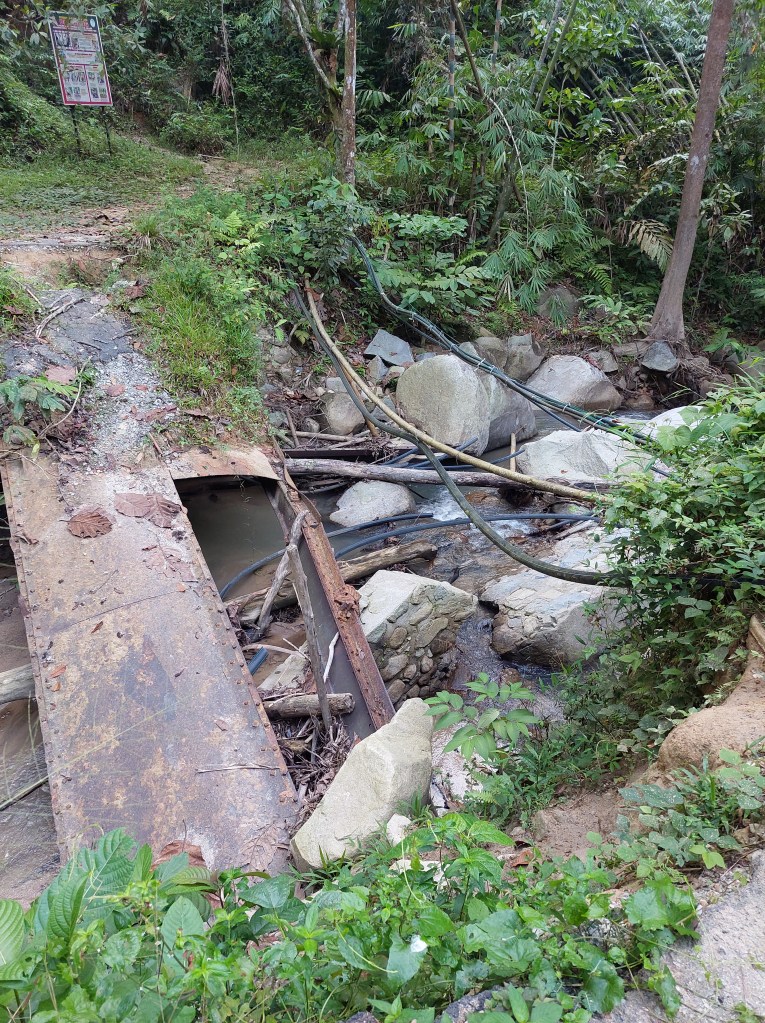
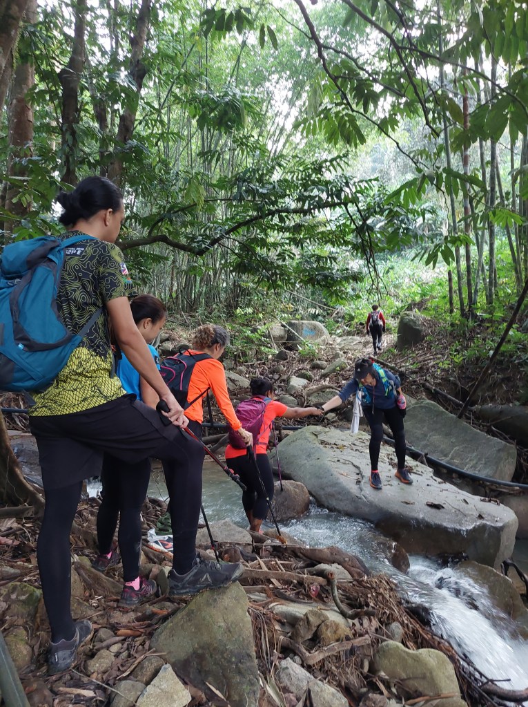
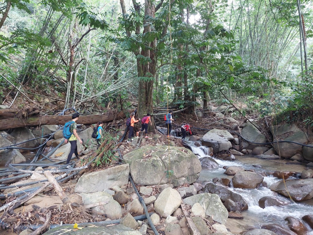
The previous route seems to be crossing a steel bridge which is now fallen during the latest flood, so we followed the new route where we had to cross a small stream. No one wants to get their shoes wet this early on the hike and Riena offered her hand and gave me clear instructions on where to step . But I ended up getting into the water. So much for following instructions and not getting my shoes wet.
Photo Credit: LuanPhoto Credit: Luan
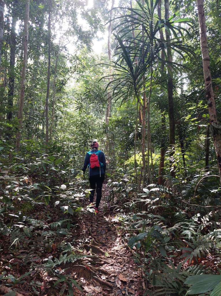
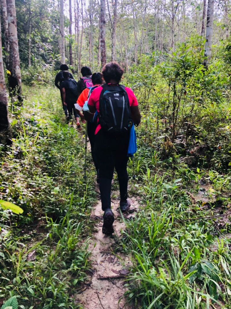
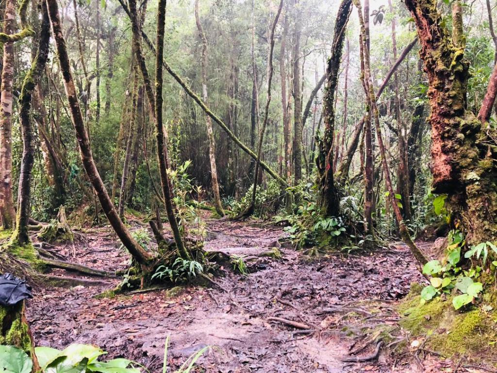
We walked past low ferns and thick lush green trees, enjoying the flat land as much as possible before the incline hits. We came across ginger flowers, if only I knew that these flowers could give you shampoo. sadly I came to know of it from a tik tok video much later after the hike.
Photo Credit: Luan
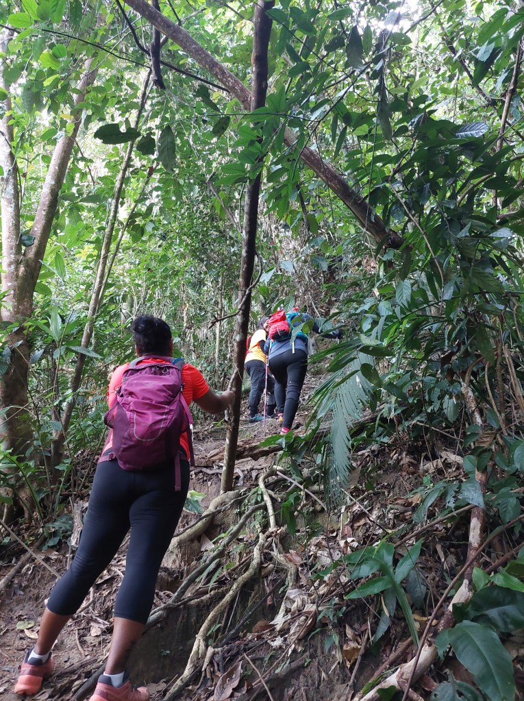
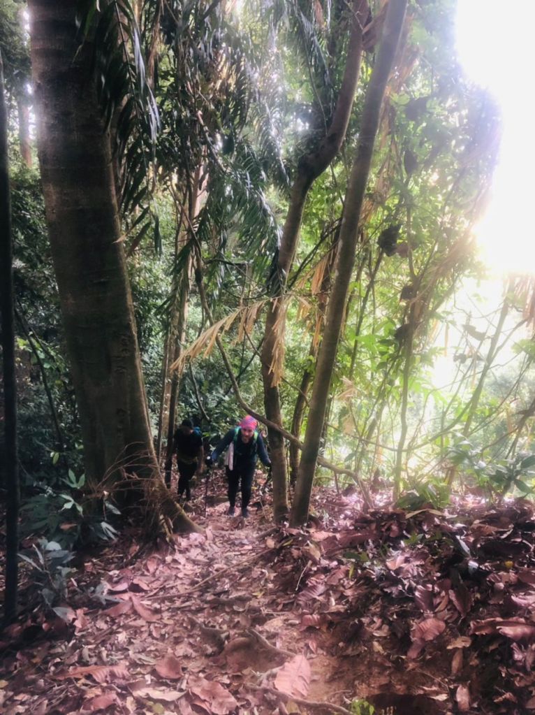
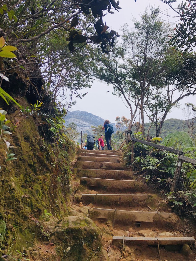
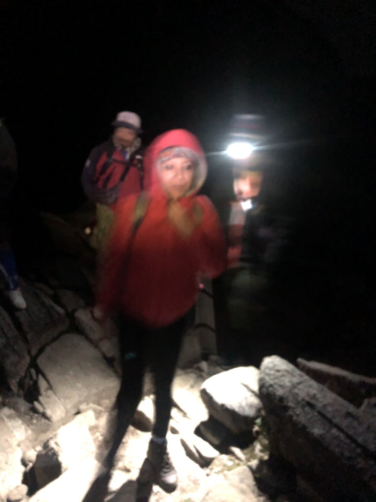
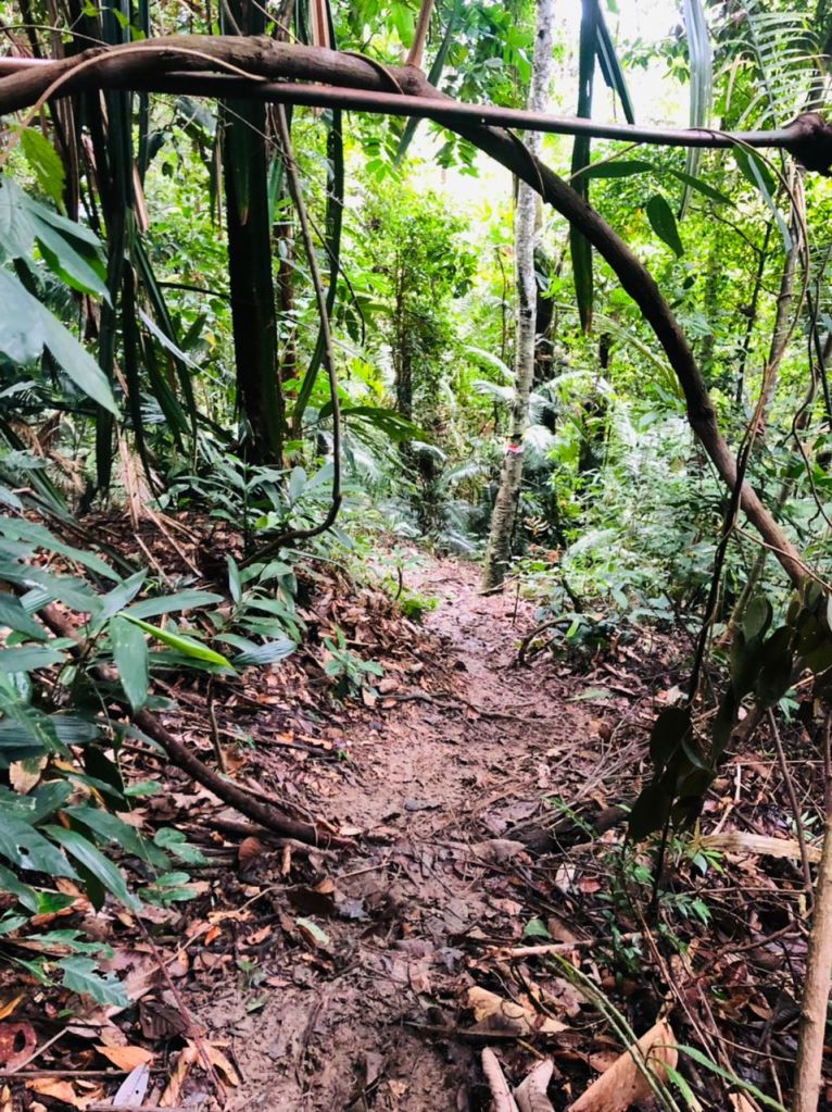
The incline started after a little hut, and I could hear Jaya calling “it’s going to get tough from here” . True to her words, the going does gets tough. Thin nylon rope is strung up in places where the slope is particularly steep or slippery. For the most part, the inclines are no less than 40 degrees, and any chance of catching our breath is slim as flats are short and few.
Photo Credit: LuanPhoto Credit: Luan
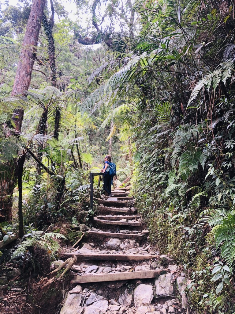
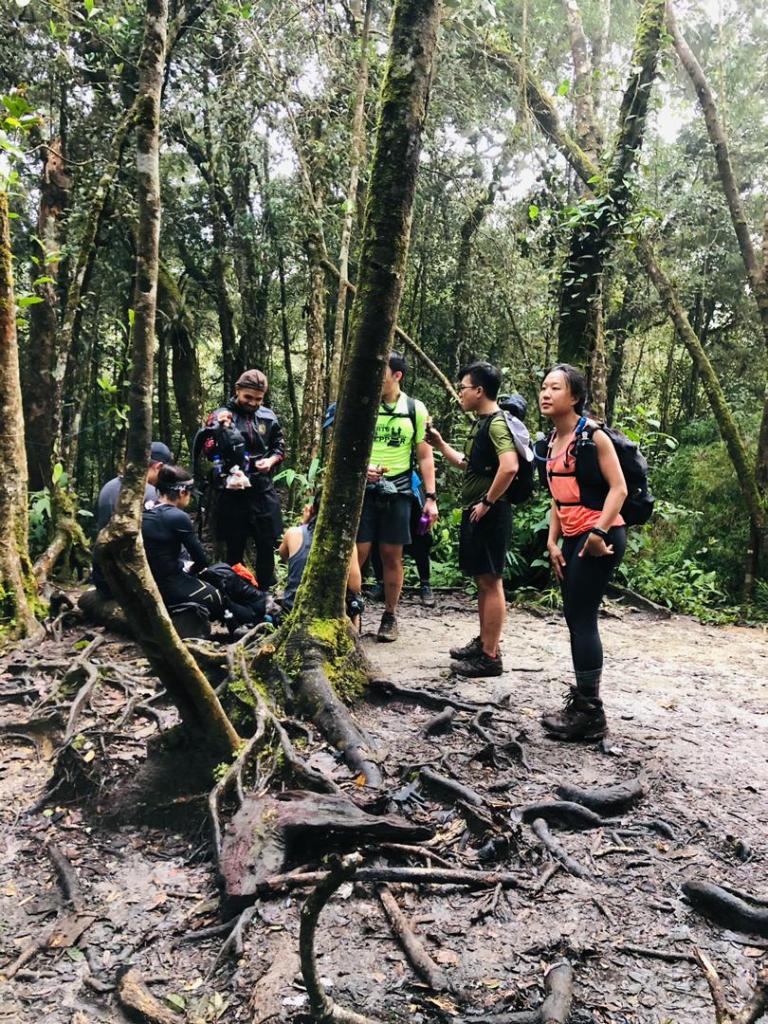
Not too long after the 2/3rd mark we came across few boulders and the climb started getting easier. It felt like the worst was over, but not without it’s challenges.
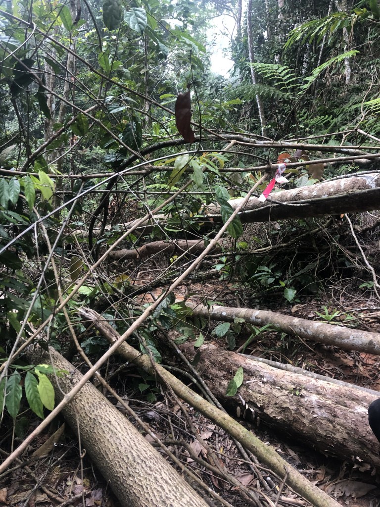
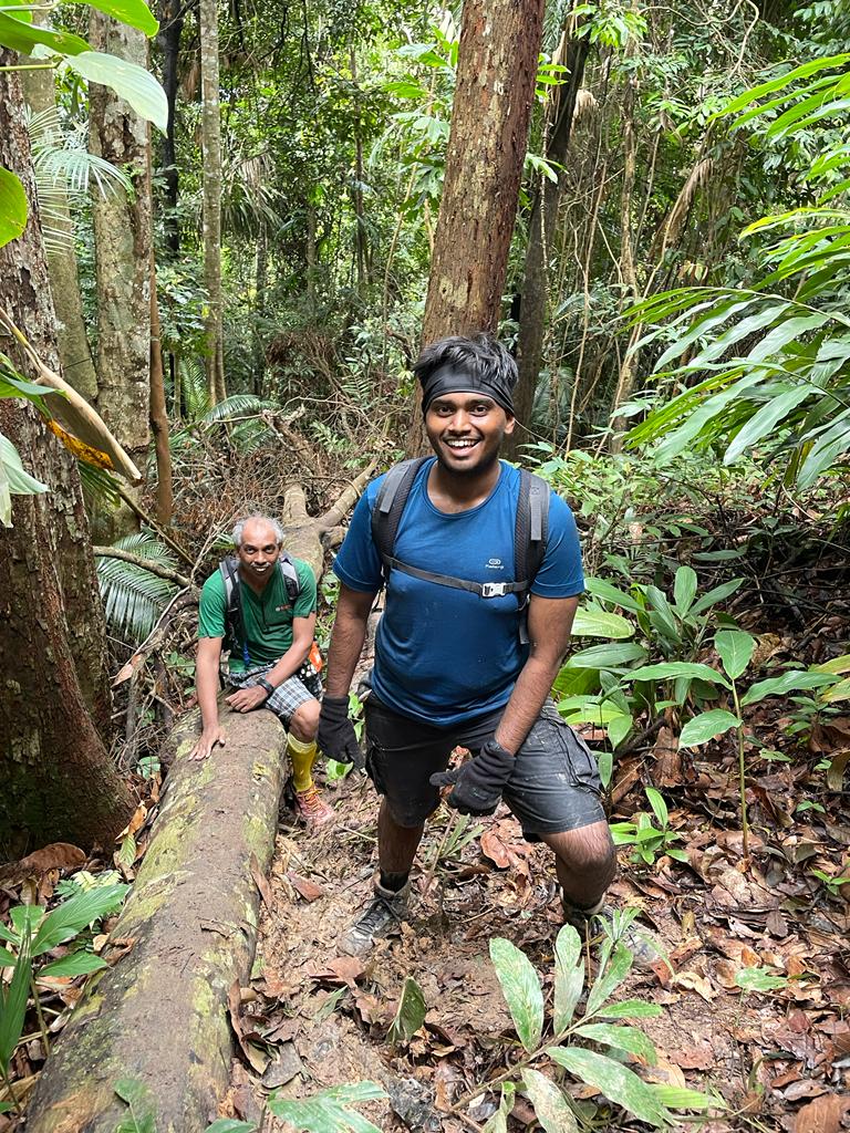
Going under and over fallen trees, passing through the trails on all fours, overcoming the obstacles Hitam threw at us, we kept moving. On and off we would hoot to check on the rest of the pack, knowing that all are right behind huffing and puffing we moved up.
Photo Credit: Luan
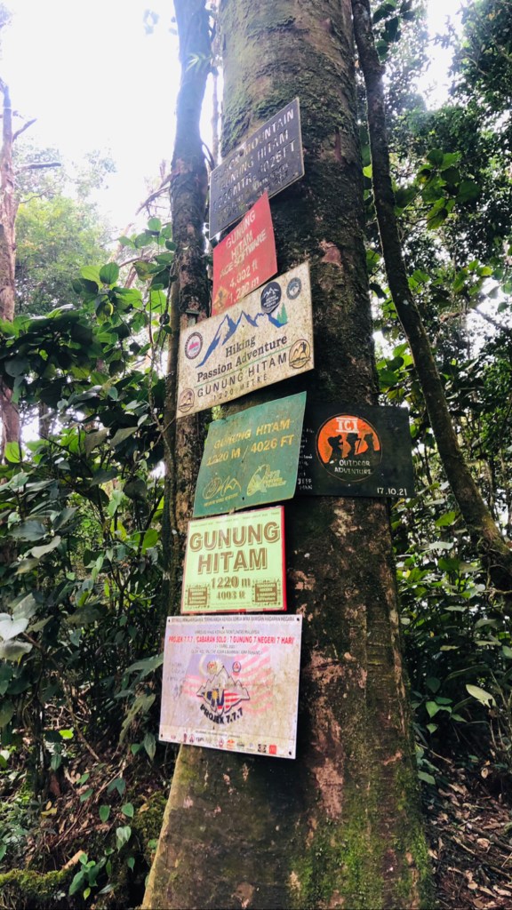
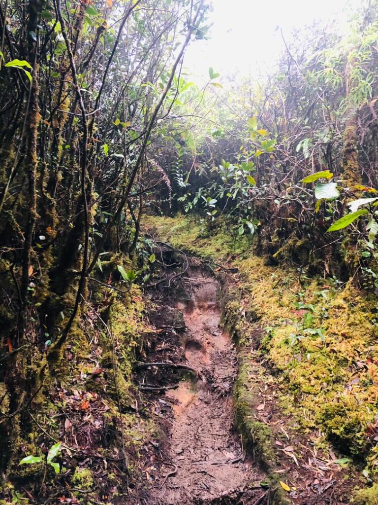
Gunung Hitam is a well-marked trail, but it may not be as popular as other trails like Nuang Pangsun or Bukit Kutu or even Datuk. One reason could be the torturous elevation. Hitam is not a trail that you could rush down either if you want to save your knees.
Photo Credit: Luan
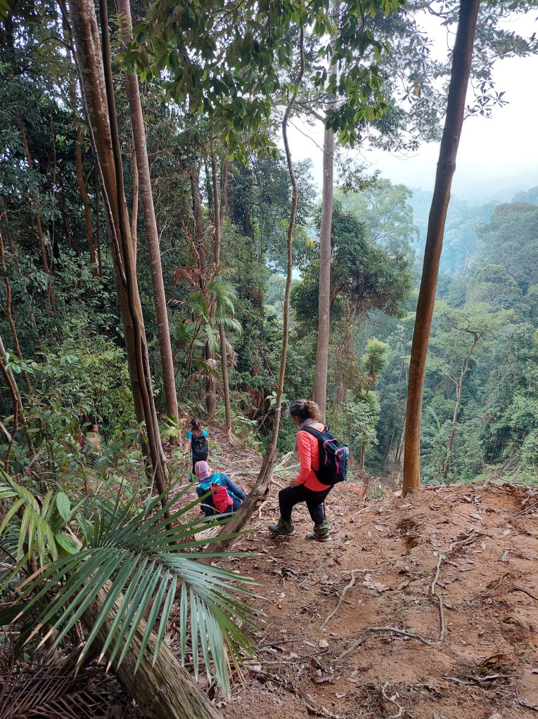
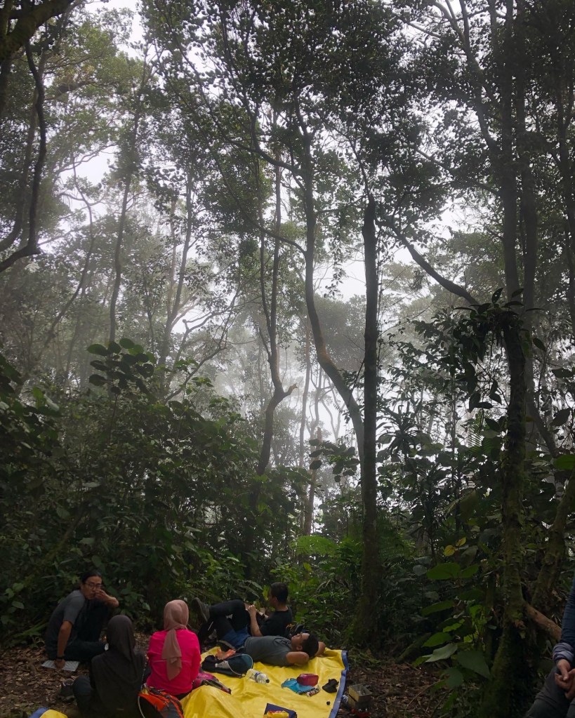
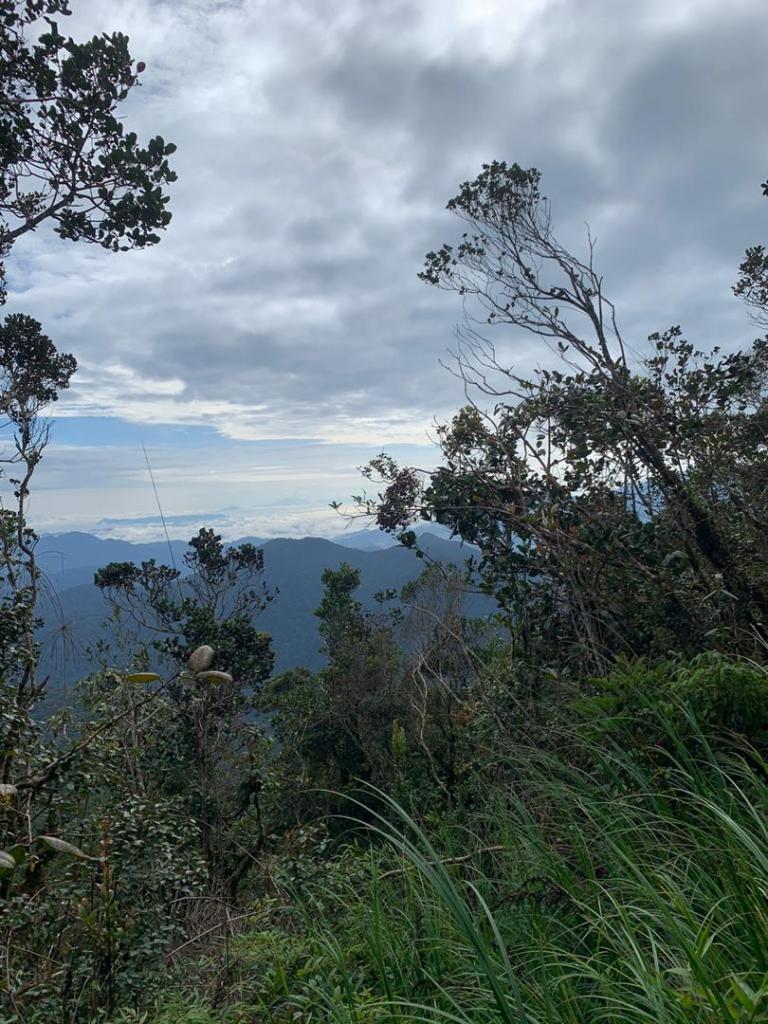
With Jaya leading the pack we kept going, on and off we would ask each other and wonder how far away we are from the summit, when suddenly I heard Jaya says, we are here, and followed by Vivien’s excitement of reaching the summit. I could see tiny white flowers lining the trail, as if to welcome me to the summit.
“After the hardest climb comes the breathtaking view” does not go at Hitam. We were greeted by a group of hikers enjoying their lunch, and suddenly we all felt hungry too.
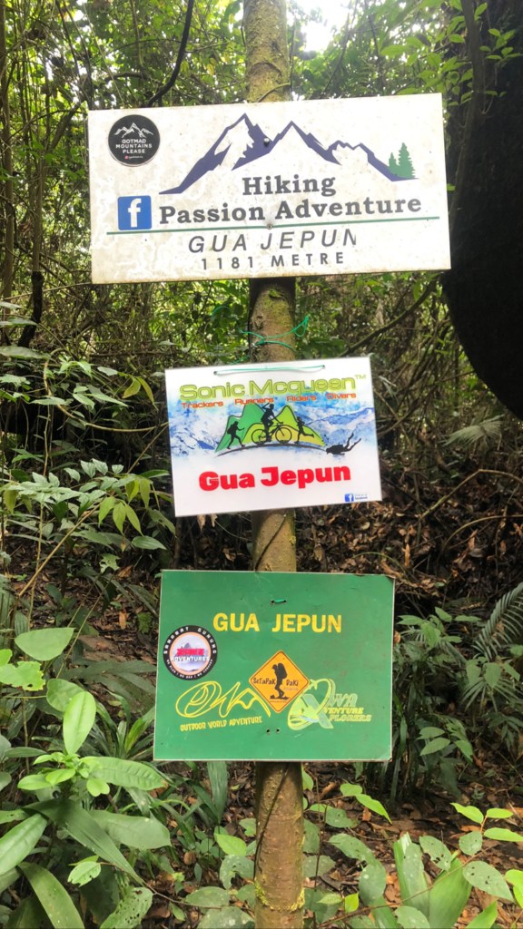
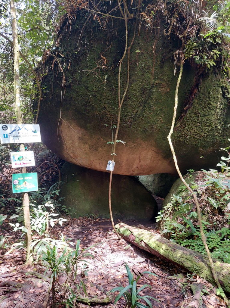
Summiting was not enough, we had to add an additional km to search for a said cave. Gua Jepun. It was a huge boulder shaped cave. Don’t really know where the name came from, but I had the impression that it was named after the country Japan, until someone pointed out that it has got nothing to do with Japan but Jepun meaning cave.
What goes up must come down. Hence our journey to decent began. On and off we would here a shriek, and someone would say what happened, is everyone ok. Yes all ok, just someone fell on the bum, nothing to worry about.
Photo Credit: Luan
Everyone seemed to be quiet excited to hear the running stream, which meant we were at the trail head. A stream at the end of the trail means getting into it, though how cold it maybe.
Another hike done, another story to tell during the roughly 16km journey.
Mount Kinabalu’s name remains shrouded in a mystery. From 1851 when Hugh Low and other climbers attempted the first recorded ascents they observed the local guides were carrying an assortment of charms and performing religious ceremonies upon reaching the summit. Since then there have been several traditional myths and legends recorded that tell the story as to why the guides revered and respected this ancient monolithic giant so much and why it was named as it was. “Aki Nabalu” or “Kina balu”
There are 2 reasons that give suggestion to why Mount Kinabalu was named as it was, the first is from the traditional tribes who believe that the mountain is essentially their version of “Heaven” or “Nirvana” with the original name being “Aki Nabalu” meaning “The revered place of the dead”. This is where their spirits go after death where they get sustenance from a moss that grows at the summit.
The second reason is attributed from the old story of “Kina Balu” where Kina translates as “China” and “Balu” means “Widow”. In one version of this tale there was said to have been a dragon guarding a precious and magical jewel at the summit of the mountain. Many Chinese soldiers had perished while attempting to relieve the dragon of its treasure and therefore many Chinese women became widows, thus the name Chinese Widow came about.
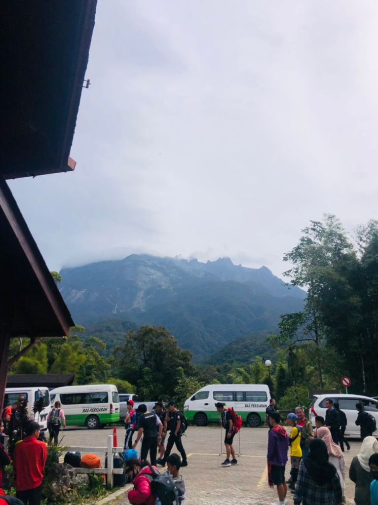
We arrived in Sabah a day before our climb and stayed at Kinabalu Park at 1585m to acclimate before our hike the next day. After sorting our back packs and the porter bag and after an early dinner we hit the bed hoping to get a good rest before starting our journey the next day.
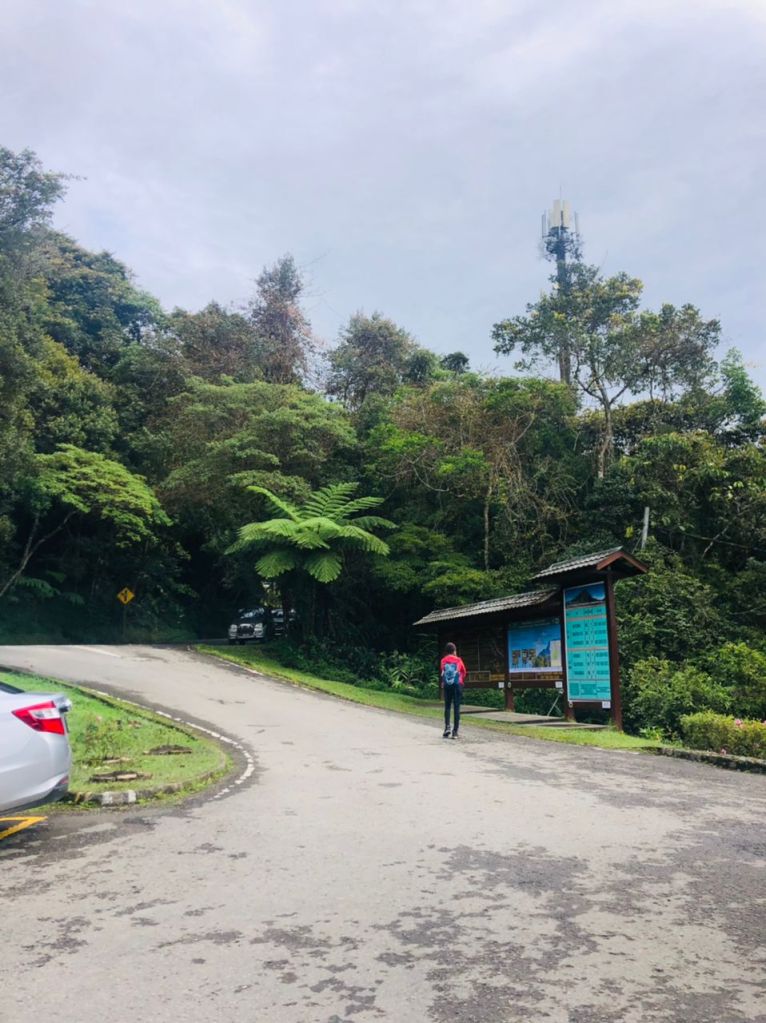
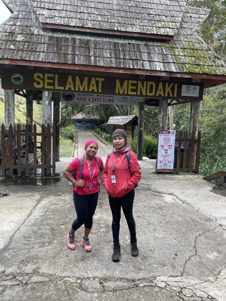
After going through the routine procedure of signing the indemnity form and getting our packed lunch, we headed towards the Timpohon gate with our guide who was also our porter. We started from the gate roughly around 9.30 in the morning. There used to be two trails, the Timpohon trail and the Mesilau trail. Mesilau trail was closed after the 2015 earthquake which took 18 lives.
Kinabalu is a World Heritage Site, and you’ll pass through several habitats and ecosystems on the way up the steamy Sabah rainforest, Beautiful grasslands, desolate rock-scapes and the famous alpine meadows. There is said to be over 5,000 types of plants, 326 different birds and over a 100 mammalian species on the mountain.
We walked up at a steady pace making sure not to exhaust ourselves, and taking breaks at the rest points which was at every 1km. At rest points we enjoyed our snacks where the squirrels eagerly joins us.
The trail up are mostly uneven steps, and rocky path and more and more steps. Though the path is not too steep it becomes tricky at places, and sometimes it’s hard to find an acceptable pace between the lungs and the legs, but once you get a good rhythm, it’s pure delight.
As the climbers who summited in the morning ascends down and as we move up, you feel envy. Knowing that you still have a long way to go. We congratulate them and they wish us all the best. You exchange few sentences, ask about weather, ask about their experience and one woman said “ we could not summit”. I can’t even imagine how that might have felt. But since there is a cut off time to reach Sayath Sayath, which is 5.30am, it seems they were not able to make it on time.
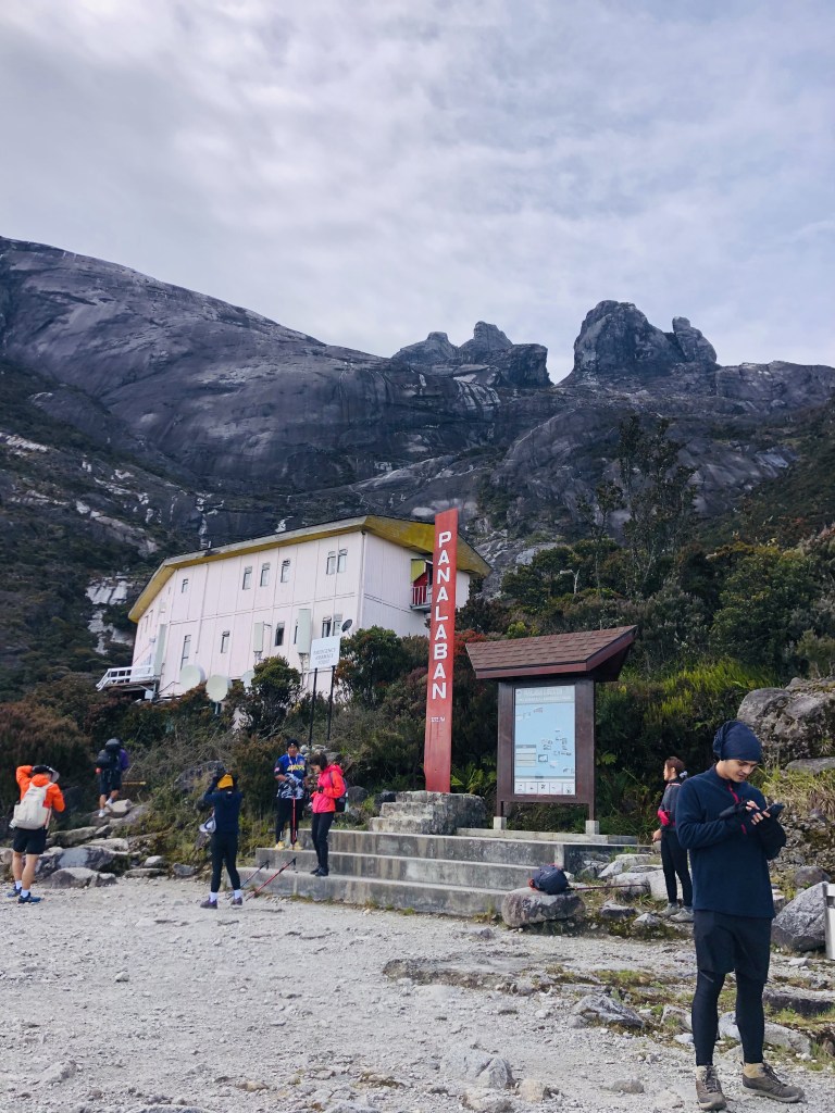
As we move up we saw porters carrying supplies to Pana Laban, the rest house at the base camp. These porters carries the supplies on their back, since it is the only way to transport them. From groceries to gas cylinders they carry it all.
As I reached Pana Laban I can feel the air thinning, and the terrain change. And it was such a relief to reach the base camp, but due to the strong wind we did not stay out for long but rushed into the rest house.
Tired and hungry after the 5hr 30min hike we waited eagerly for the food to be served, and got into the long queue. Though we all knew we had to wake up by 1.00am few seemed to have been able to sleep since we can hear doors closing and opening and people talking through the thin walls of the dorm. We shared the room with two other Dutch girls.
After a hearty breakfast at 1.30 am with our headlamps on and layered up we were all set to walk into the unknown. After walking up and down the steps I started feeling extremely hot and had to shed off a few layers. Till we reached Sayath Sayath around 4.00am it was warm, but after Sayath Sayath we go out to the open mountain and the cold air hits us immediately. Despite the cold and the dark I felt the excitement of trying to reach a goal.
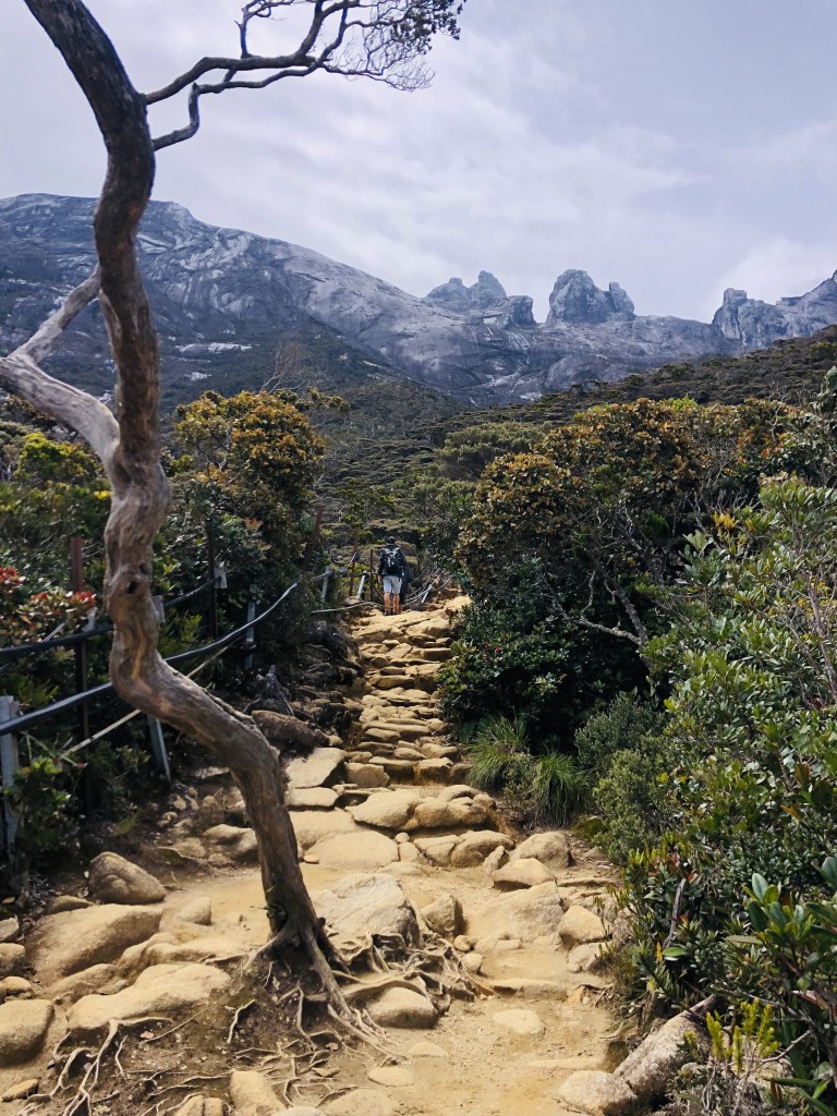
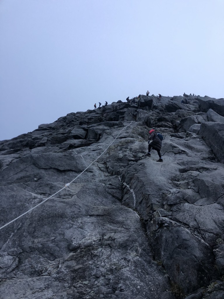
There is a white rope to guide you along and to haul yourself up if you need the extra support. The incline is not as steep here but the surface isn’t completely smooth either, so you need to be careful not to trip. One can only imagine how beautiful it would have been if there was a full moon.
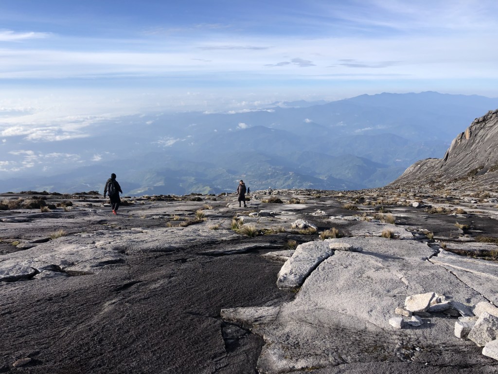
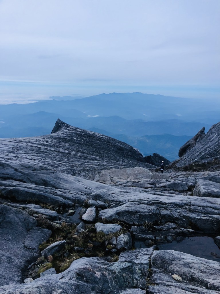
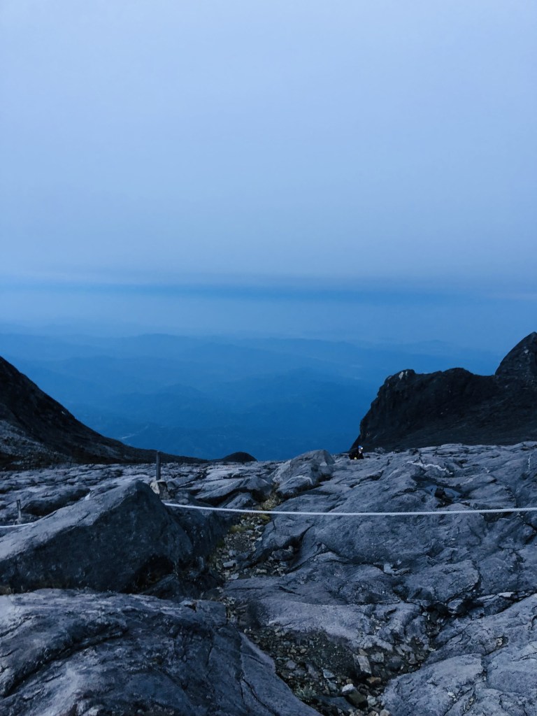
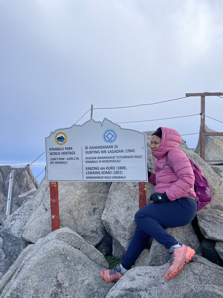
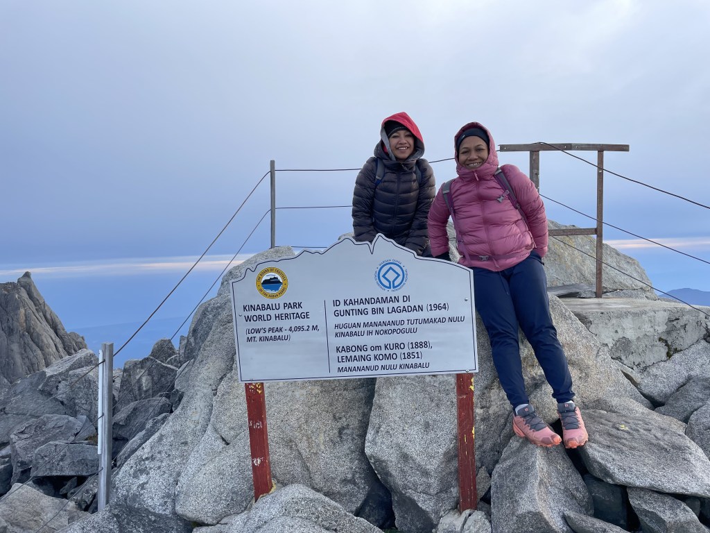
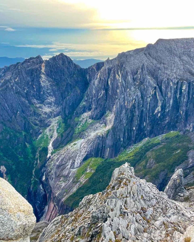
The last stretch to the summit of Low’s Peak is an exhausting scramble over huge boulders. By now the thin air had really hit me, and with the peak just few hundred meters away I kept pushing myself. I looked around, and with the sun already out I could see the giant peaks and nearly 45% incline rock that I just climbed.
So here I am at the peak, after climbing 6 kilometres worth of steps, up through the lowland jungle, another 2.7km of steep rock, to around 11,000 feet above sea level exhausted, cold and warm, but in awe of what I was seeing around. The entire mountain peaks got bathed in gorgeous early morning rays in all its glory. No camera can do justice to what lies Infront of your eyes.
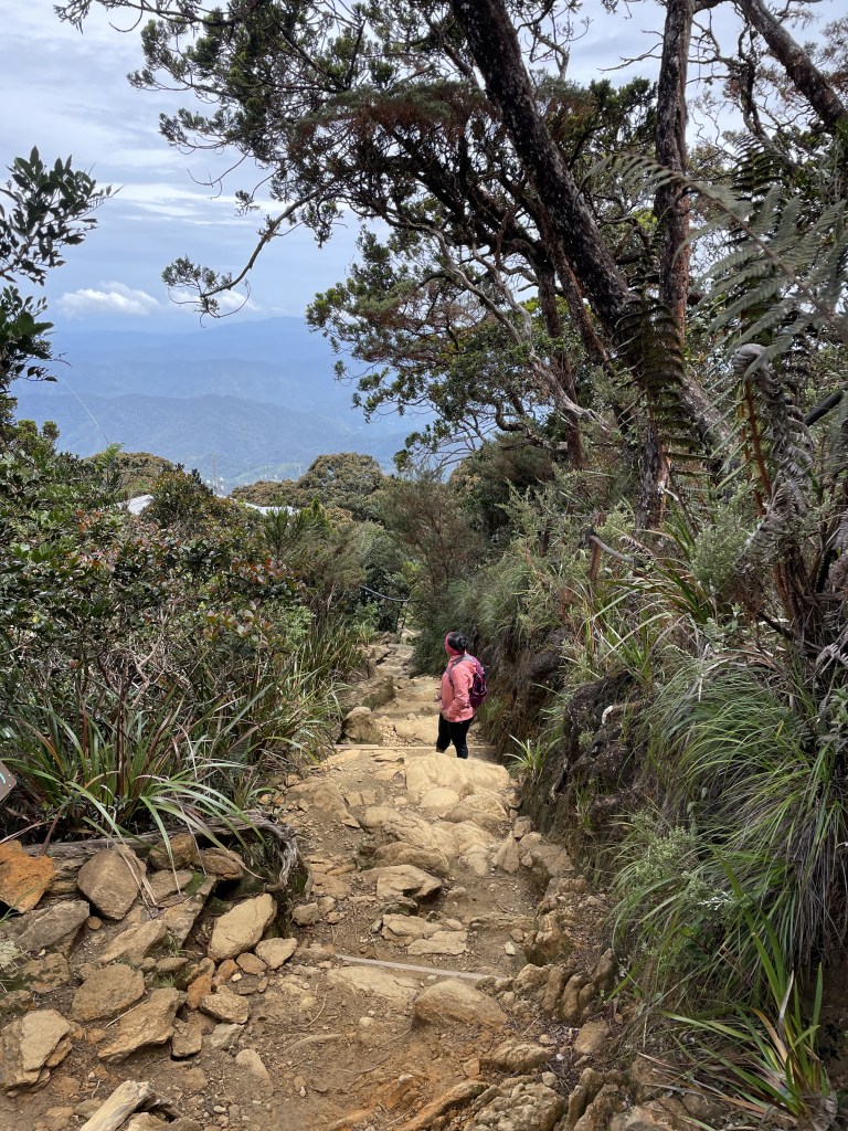
What goes up must come down, we took our own sweet time to walk down. Our guide , guided us through a different path rather than following the white rope which may have taken a bit extra time, but hey, why rush when you are on the mountain.
By the time we reached the base camp I was all hot and sweaty, and badly in need of a shower. But with no hot water in the toilets I needed to be creative to wash myself and freshen up under the freezing water.
After breakfast we left the base camp around 10.00 am feeling accomplished. The best part of going down was wishing those coming up “all the best” and hearing them say “congratulations” felt so good. One lady said to me “wah, such a big smile”, I said to her “don’t worry, you will feel the same when you come down tomorrow”
As I continued my journey down, engulfed in my own thoughts listening to the surroundings, and when I heard the waterfall I knew I am just round the corner to the finish line.
As I sat on the bench at the Timpohon gate around 2.30 in the afternoon, waiting for my sister and the guide to come out, all I could do was reflect back on the beautiful journey I just had. I climbed a mountain to celebrate my 50th birthday, with my sister. As she says, we just did a “normal” thing.
Waking up at 3.30 in the morning to go on a hike might sounds crazy for some of us, but that’s how most regular hikers are. We wake up at odd hours make sure we have every thing we need, our bags packed, enough water and food for the journey, and go through the check list once again so that we don’t miss anything.
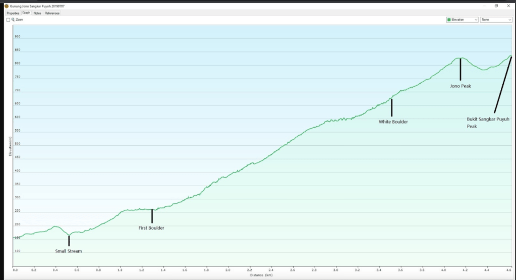
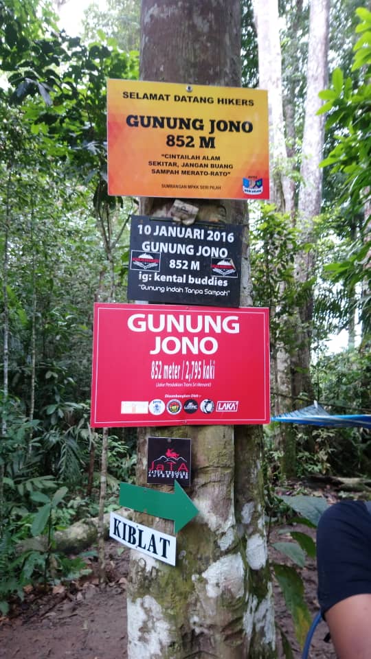
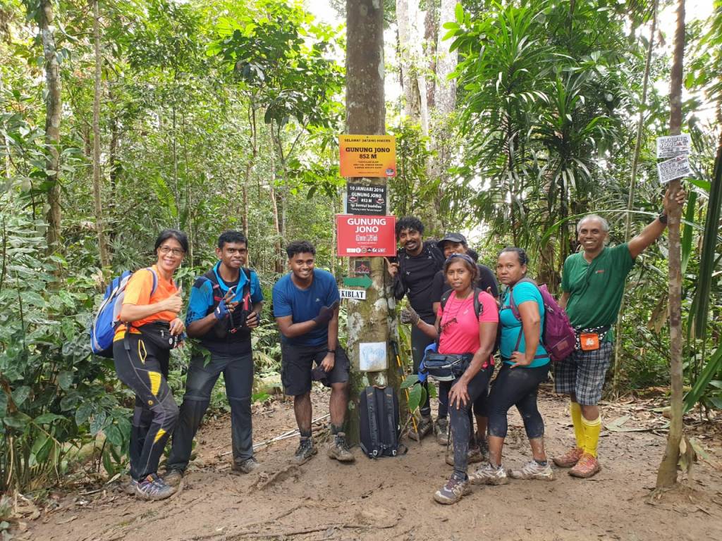
With the Hi-kers, we set out to explore Gunung Jono. I could not find much to read about this trail, hence was a bit excited to find out what’s in store for us. Gunung Jono is located in Kuala Pilah, one of the stated of Negeri Sembilan. To be exact it is located in Senaling Province. We drove pass Sri Menanti Palace before we reached the entrance. Gunung Jono stays tall at 852meters, even though it’s the almost the same height as Gunung Angsi, the terrain is much tougher to climb.
After a hearty breakfast of roti canai and dosai at a restaurant in Bukit Putus we headed towards the trail head. We reached the trail head a bit after 9.00am which was much later than planned, but none seems to be worried since we were expecting to be down with in 5 hours.
The walk started through a rubber plantation and it was not thick jungle. But rather an open field. The trail started from a tree with a marked red ribbon but Dr. Vick reminded us the actual trail would start from the base of the mountain, which may take some time to reach.
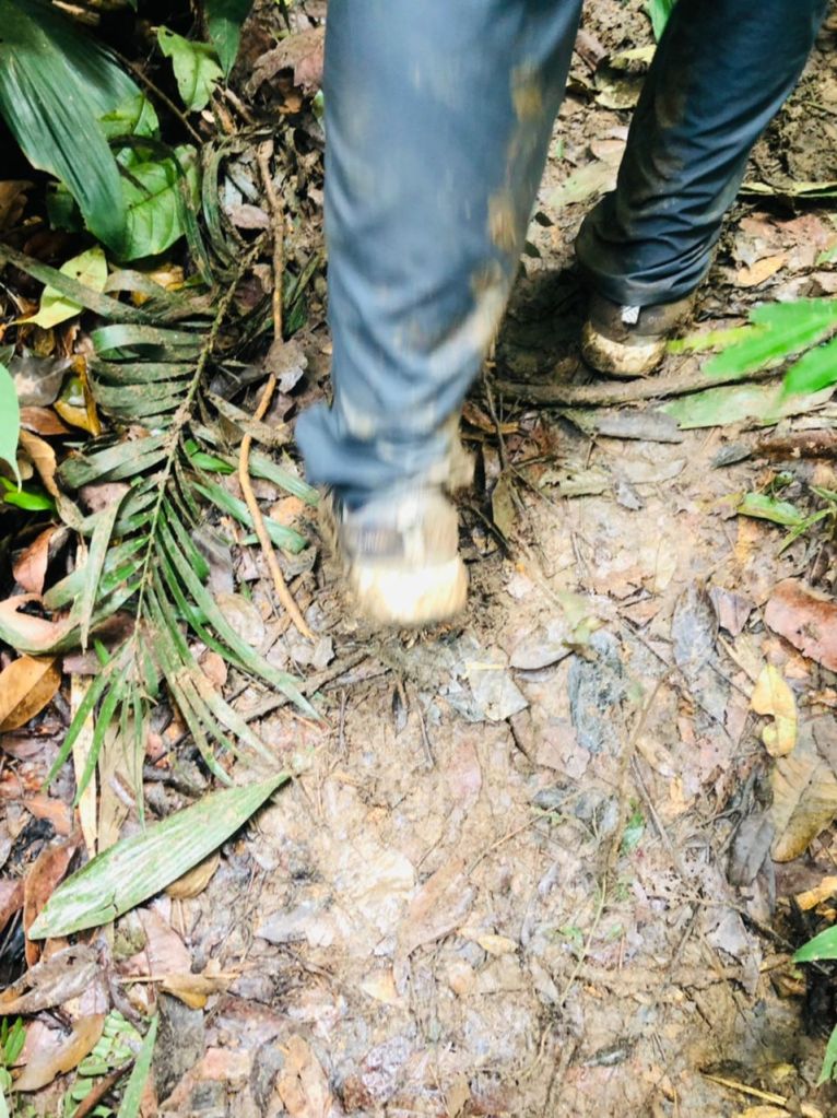
Since the beginning of the hike all I could see and feel is mud. The trail is well marked with red ribbons and from the base of the mountain it’s just one way up.
Sliding and slipping we continued our journey, up the slippery slope. The shoes felt so heavy due to the mud. One thing I noticed was there was not much foot hold like most trails, and even on the side there are hardly trees to hold onto at most places. There were ropes at certain areas, but most of the time it’s just you, yourself and your hiking stick, if you have one. There were few times I was on all fours to prevent myself from sliding down. On and off I would feel the person behind me giving a push up, so that I will not fall backwards.
Once in a while I could hear a hiker saying “how do we come down” and I told him, let’s not think about it, till we have to think about it.
As a I walked up I could feel my calves giving up on me few times, and I kept complaining to Dr.Vick. Of course , it’s muddy and it’s a steep slope, so I was applying twice the pressure on my calves to move up. As I moved up few times I got scared of getting cramp, so whenever I felt the pain I took a break and made sure I stretched, cause I knew if it started to cramp it would be really hard to continue.
Just before I reached the peak I saw a familiar face, and I got really excited to see my dear friends from the bootcamp, Kumar and Melissa coming down from the peak. The two very experienced hikers, where else to bump into them after year, other than on a trail.
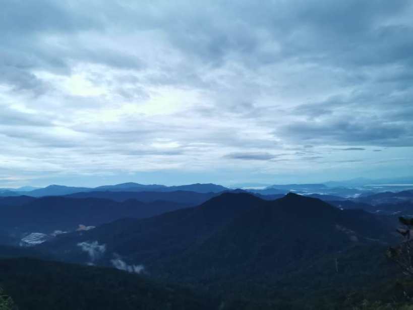
After a lot of pulling and pushing and sliding we reached the peak roughly after 12 noon. Though I have read there would be no view, I was expecting something exciting and interesting rather than just a tree with the usual boards. Oh well, just have to consider this as an exercise.
After snacking on the food we brought we started our journey down, surprisingly it was much easier than I thought it would be. It was around 1pm and in my head I calculated and had a feeling we should reach the stream by 2.30 to 3.00 pm.
Not long after we started descending one of the hikers started having cramps and Dr.Vick and another fellow hiker started to help him, It was funny to hear some of the phrases coming from them, asking him to stretch different directions.
Once he felt at ease we started to walk down and then we heard someone calling Dr.Vick again from above saying he is needed. While going up he said “ today is one of those days”
Since I was down I could not clearly see what was happening but one of the hikers decided to go up to check what’s going on. By this time two of the hikers had already gone down and I knew they must have gone far and would not hear me even if I call them. Luckily I had phone signal so I called them to let them know that we may take a while.
After what seem like forever the group above started descending down. A fellow hiker had twisted his ankle and his foot needed to be bandaged . I really don’t know how he managed to come down the slippery trail, but with the help from other fellow hikers and taking rest in-between, he was able to reach the trail head.
Though it was a weekend we did not meet many hikers on the trail so I was assuming that this is not a very popular trail among the hikers. It could be since it’s the rainy season and regular hikers know it would be muddy. Every time I complained about it , Dr.Vick would say “where is the fun if it is not challenging” oh well. It’s true too.
After the very eventful hike we reached the stream roughly after 4pm and I was so happy to get into the stream to remove all the mud from the shoes and my body. It felt really nice in the cold water.
So what’s my take on Gunung Jono? Would I do it again? I may , but I would wait for dry season since the trail can be a very good training ground. Until then.. its bye bye Jono.
On the day I was to leave for the Yong Belar hike I met with a friend for lunch. I shared about the upcoming hike and he said “I enjoy fishing, I can spend hours on a boat, in the rough seas, but at the end of the day I get to take home fish, and put food on the table, but what do you get from a hike”
Ever since I became interested in hiking I have been reading about the G7 of Malaysia, G, meaning Gunung in Malaysian Language and 7 being the tallest 7 peaks in the peninsular. Few times during the past year one of my bootcamp instructors asked me about the G7 and he knows that I have an interest to do these 7 summits one day. And Yong Belar being one of the G7, he invited me to join the group.
Gunung Yong Belar is located at Blue Valley Dam, Cameron Highlands,on Titiwangsa Range between Perak – Kelantan border, and it is the 3rd highest mountain in the peninsular.
When I shared the details of the hike with some of my friends and kids, they all felt it was crazy to start the journey from KL at 11.00pm at night and continue hiking without sleep. I felt the same since I have never tried a hike without sleep, but I have done runs, so why not try this, there is always a first to everything.
We left KL at about 11.30 at night and during the 3 hours journey some enjoyed their little beauty sleep. I tried to sleep but I couldn’t. We reached the meeting point a little earlier than 3am, after logistical arrangement we went onto the four wheel to reach the starting point. I don’t know why I thought sitting behind would be more comfortable than standing up. Half way into the 40 min journey I had to stand up since I wanted to save my back and head from continuously banging as the vehicle passed through the muddy road. I stood there looking out in horror, squatting down whenever a branch seems to be too low.
With headlamps on, we all walked towards the trail head. As we walked I looked up into the sky, it was mesmerising to see the stars, it’s not everyday you get to see such a view when you live in KL. After about 20 minutes of walking through neat rows of cabbage we arrived at the trailhead.
From here the undulating trail winds its way up towards the first campsite, Kem Tudung Periuk. The pathway was painfully narrow, and as I walked past I was hoping to capture this trail when I returned back, hoping it wouldn’t be dark then.
After passing a few scenic viewpoints and false peaks we arrived at Kem Tudung Periuk, the first camp site a bit later than 7.30am. We didn’t spend much time there, but enough to fuel our selves for the next leg of our journey. Which is towards Kem Kasut.
Right after Kem Tudung the trails descended down a rocky trail, with guidance from Kumar, the most experienced hiker in the group, I too squatted down and walked down the rocky trail. As I was going down I saw the trail right in front of me, which was going straight up. I just couldn’t help myself, but said it out loud, and I heard from behind “Hey, I don’t want to see it”
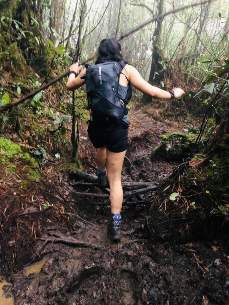
Even though the terrain was gentler in elevation, the real journey of walking in the mud started from here. Some of our fellow hikers were way ahead of us and few behind, me with two other hikers kept on going through the muddy trail. We were carefully picking our way across large unavoidable pools of peat on whatever roots and fallen branches in our sight, but our shoes get sunk in up to our ankles anyway. One of our team hikers who was moving a bit ahead, once in a while would say “ I think it gets better from here” but it never got better, the mud never got any lesser. When she spotted young bamboo plants she said the same, and it brought our hopes up, but a few steps forward it’s mud again. She moved a bit faster so I called out to her and said “how is it up there”, didn’t hear her response, so I realised she must and moved further up. When I said that, my bootcamp instructor, who was with me said “that reminds me of a Chinese story, If the king has to go out, someone will go before the king and check how the road is, and the person would come back and inform if the road is safe for the king to go ahead”, I was trying to see if the path ahead is clear of mud. So much for my wish.
The said to be 3 hours to Kemp Kasut seems like forever, whenever we would hear voices, my fellow hiker would say ‘ we are nearer” and then we reach to see it’s some other group. After it happened twice we decided to not to bring our hopes up but just keep going till we reach Kemp Kasut.
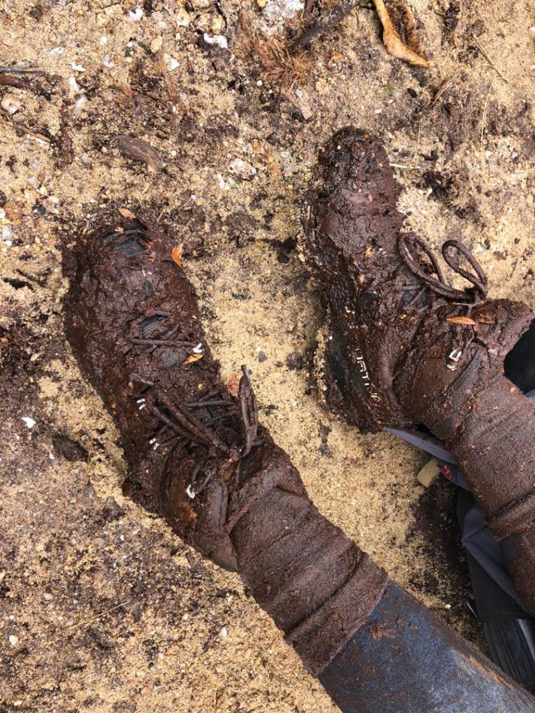
If you are someone who cannot deal with mud and the muk Yong belar is not your place. There were few times I had to struggle to get my shoes off from the mud, had to turn it left and right to break the suction.
Few of us got reunited at Kemp Kasut, and we decided not to spend too much time there, but start the journey towards the peak.
I think the biggest lie you hear when hiking is the peak is just 20-15 minutes away from where you are. But that 20-15 min always seems like hours.
As I was going towards the peak, the ultra runner, Jaye, who I met at Gunung Liang was coming down, as we passed we said our hi’s and she mentioned about reading the blog. What a small world.
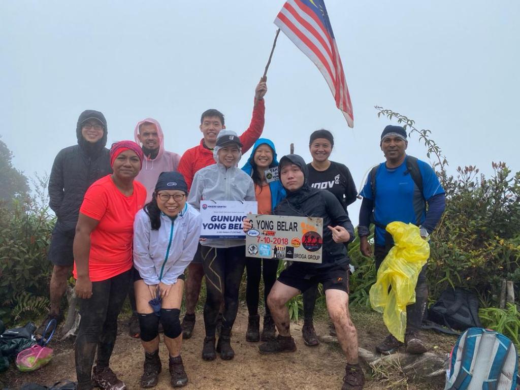
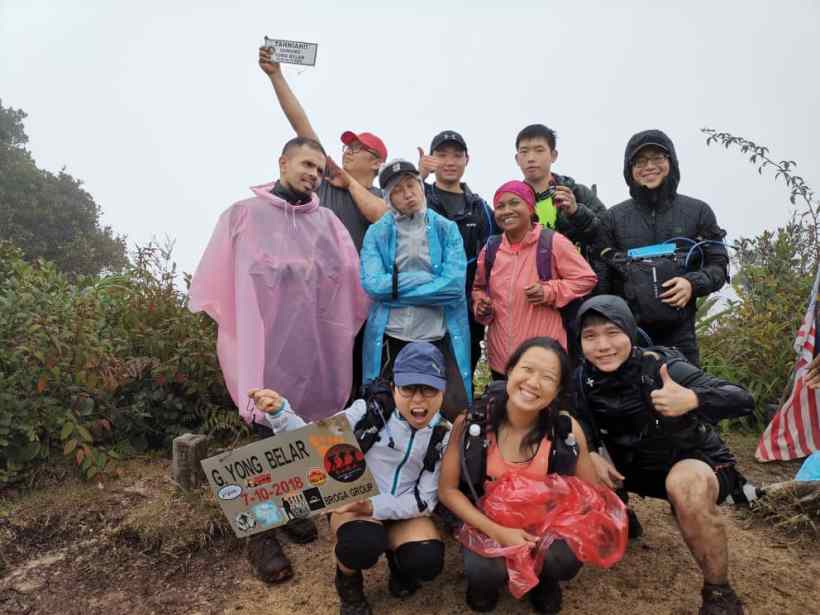
Yong Belar peak was an open flat land, and the supposedly visible peaks remained hidden due to a sea of clouds. While at the peak we tried to enjoy our chicken rice provided by the organiser. There was a festive atmosphere at the peak, whenever someone climbed up the cheers to congratulate the person continued. Other than two from our team everyone else was at the peak, and we got conflicting information saying they had returned back. But they both surprised us by climbing to the peak. After group photo sessions, and celebrations and after acting for a tik tok video we started our journey down.
Wanting to go out of the trail before dark was in my head, but looking at the time and the pace I was moving I knew it was not possible. If only there was no mud, I could walk much faster, I could even run here, I could do this, do that… the thoughts kept getting into me as I walked alone. I wanted to move as fast as I could, as far as I can, but the mud keeps on slowing me down. I met up with one of the guides and he accompanied me, when I asked him how far to kemp kasut, he said to me at this pace you are moving in another hour and half. We talked about how he started hiking and his experience. Right before we reached Kemp Kasut I came to know that even if I rush and move to trail head, I still need to wait for the rest of the team members who are inside the trail. Hence I decided to wait back and leave the trail with others.
After resting a bit at the campsite, and asking the exact direction to leave the campsite we started our journey towards the trail head. Some were talking about how tiring and exhausting it has been, to never going to do a long hike ever again, and consoling our dear friend who was extremely exhausted, we all walked our way past the narrow trails, with one of our instructors leading the pack. He kept encouraging us to keep on moving, and his just 2 hours seems to be another of those lies. Whenever the trail ascends, my friend would say “again going up” and I had to remind him “remember we came down when we started”
Each hike is a story to tell. Each hike has it’s unique incidents. Yong Belar was done with an awesome group of friends from my GoMAD bootcamp. From very experienced to newcomers, they all showed immense mental strength, along the challenging hike. How tired you may be, how exhausting you may become, even when you feel like you can never go on any more, you push yourself till cool down. Just like in the bootcamp session.
It was almost 4.30 am when I was able to go to sleep, but I was awake way before 8.00, and I knew I had to attend to all the mud that I brought home last night. Blackened toenails and mud stained hands and feet need to be cleaned too.
This morning my friend asked me “now happy” . Yes I am , and I hope this answers your question. What do I get from a hike? a story to tell, an experience to share, an opportunity to inspire someone else. And now I have you to read this.